
Teide Cable Car Route: Everything You Need to Know


Teide Cable Car Route

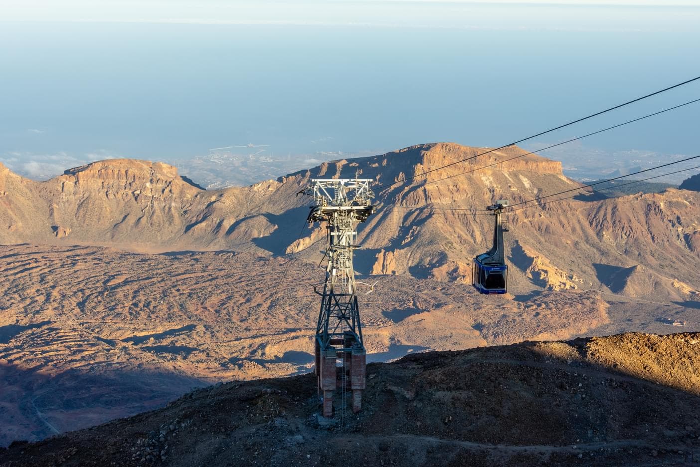
The cable car experience begins at the base station, located within Teide National Park at an altitude of 2,356 metres. Here, travellers can purchase tickets, visit the café for refreshments, or browse through the small souvenir shop. The station also includes parking facilities, restrooms, and an information desk with details about the park’s geology and trails. Many visitors recommend arriving early in the morning to avoid long queues and enjoy clearer skies. Before boarding, it’s wise to dress in layers, as temperatures are cooler at higher altitudes. This stop is the perfect preparation point for the breathtaking ascent ahead.
Location: Carretera TF-21, Teide National Park, Tenerife, Spain

Arriving at the upper station, visitors step into an entirely different world of crisp mountain air and panoramic landscapes. At 3,555 metres above sea level, this station serves as a gateway to Mount Teide’s most spectacular trails. Three marked routes begin here, offering varying levels of difficulty and stunning views. The station itself has basic facilities such as rest areas and information points, but the real attraction lies outdoors. From here, it’s possible to see Tenerife’s coastline, neighbouring islands, and endless volcanic formations. Warm clothing is essential, as temperatures can drop sharply compared to the base station.
Location: La Rambleta, Mount Teide, Tenerife, Spain

One of the most accessible trails from the upper station is the La Fortaleza route. This relatively short and easy path leads to a viewpoint overlooking northern Tenerife and the distant Anaga mountain range. Because of its gentle incline, it is suitable for families, casual hikers, and visitors still adjusting to the altitude. Along the way, you’ll pass unique volcanic rock formations and barren yet striking terrain. The viewpoint itself offers a peaceful atmosphere with sweeping views that extend beyond the island on clear days. Carrying water is recommended, as the dry volcanic landscape can quickly dehydrate travellers.
Location: Accessible from Upper Station, Mount Teide

For a more dramatic experience, the Pico Viejo trail is an excellent choice. This moderately challenging route offers breathtaking views of the massive Pico Viejo crater, one of Teide’s most striking volcanic features. The trail also reveals wide panoramas of Tenerife’s western coastline, and on exceptionally clear days, visitors may spot other Canary Islands such as La Gomera, El Hierro, and La Palma. Though the hike is not overly long, the rocky terrain and thinner air require steady pacing. The destination is worth the effort, rewarding hikers with unforgettable views and a deeper connection to Tenerife’s volcanic past.
Location: Accessible from Upper Station, Mount Teide

The Teide Cable Car gives access to several hiking trails, ranging from easy walks to more challenging treks near the summit. The Montaña Blanca route is highly recommended for its breathtaking volcanic landscapes, diverse rock formations, and panoramic views of Tenerife. Visitors should wear sturdy hiking shoes, carry sufficient water, and start early to avoid the midday sun. Sunscreen, hats, and layered clothing are essential because weather conditions can change rapidly at high altitudes. Stick to marked paths, follow trail signs, and maintain a moderate pace to fully enjoy the experience safely. These trails allow visitors to explore Teide’s unique geology closely and immerse themselves in the volcanic environment, making the cable car journey far more than just a ride; it’s a complete adventure.
FAQs
How long does the Teide Cable Car ride take?
The ride takes about 8 minutes from the base to the upper station. It’s quick but offers unforgettable views of Mount Teide’s volcanic landscapes.
Do I need a permit to reach Teide’s summit?
Yes, a special permit is required to hike the final 200 meters to the summit. Permits are limited, so booking online in advance is highly recommended.
What’s the best time of day to take the cable car?
Morning hours usually provide the clearest skies and calm winds. Afternoons can be windy, and service may get suspended if conditions worsen.
Is the Teide Cable Car suitable for families with kids?
Yes, families can enjoy the ride as it is safe and easy for children. Just make sure to carry warm clothing, as the temperatures are colder at higher altitudes.
How should I prepare for the high altitude at Teide?
Move slowly and stay hydrated, since the thin air can cause lightheadedness. Allow your body to adjust before starting any trails at the top.
Should I buy tickets online or at the station?
It’s best to book online to secure your spot, especially during peak season. Tickets are also available at the base, but lines can get long.
Can I hike down instead of taking the cable car?
Yes, there are marked trails that allow you to descend on foot. However, hiking requires good fitness and proper shoes, as the terrain is steep and rocky.
What facilities are available at the base and upper stations?
The base station has parking, a café, and a souvenir shop for convenience. The upper station offers rest areas and access to several hiking trails.